


Survey of India Partners with Periyar University for GIS Research
|
General Studies Paper II: Government Policies & Interventions, Growth & Development |
Why in News?
Recently, the Survey of India has signed a new Memorandum of Understanding with Periyar University to advance research, curriculum development and training in Geographic Information Systems (GIS) to strengthen academic-industry links and enhance skills in GIS technology, boosting opportunities for students and researchers.
Highlights of Survey of India–Periyar University MoU
- Academic Collaboration: The MoU between Survey of India (SoI) and Periyar University will focus on advancing Geographic Information System (GIS) and surveying education. It aims to integrate cutting-edge geospatial science into academic curricula through joint curriculum development.
- Research and Project Partnerships: Under this agreement, both institutions will collaborate on research projects in areas such as spatial data analysis, remote sensing applications, and advanced surveying techniques. Periyar University will work on real-world geospatial problems using SoI data, tools, and methodologies.
- Training, Workshops, and Practical Exposure: A major component of the MoU is structured training programmes, workshops, seminars, and expert lectures by Survey of India professionals. These activities will cover field surveying practices, GIS software proficiency, and data interpretation skills, helping students and faculty gain hands-on experience with state-of-the-art geospatial technologies.
- Internships and Industry Linkages: The partnership includes internship opportunities for students to work with SoI’s regional geospatial directorate and associated bodies. Internships will provide exposure to real project environments, enabling learners to apply theoretical knowledge to tasks such as map creation and geodetic surveying operations.
- Technical Assistance and Resource Sharing: Survey of India will offer technical guidance and resource support for geospatial labs and academic activities at Periyar University. This includes access to geospatial datasets, software tools, expert consultations, and collaboration with the National Institute of Geospatial Science and Technology (NIGST) for online/offline modules.
|
Survey of India
|
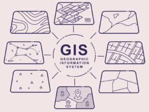
What is Geographic Information System (GIS)?
- About: A Geographic Information System (GIS) is a computer-based framework for capturing, storing, managing, analysing, and visualising geographically referenced data—information linked to locations on Earth’s surface. It integrates spatial coordinates with descriptive attributes to reveal patterns, relationships, and trends across space and time.
- Invention: The modern concept of GIS was pioneered by Dr. Roger Tomlinson in 1963 while working with the Canada Land Inventory (CLI) project. He developed the first computerized GIS to analyze land capability for agriculture, forestry, and wildlife. Tomlinson is widely regarded as the “Father of GIS.”
- Types: GIS primarily uses two data models: Vector and Raster.
- Vector data represents discrete geographic features—points (e.g., cities), lines (e.g., roads), and polygons (e.g., lakes)—with precise coordinates.
- Raster data consists of grid cells or pixels, each with values representing continuous information such as elevation, temperature, or satellite imagery.
- Examples: GIS software includes the industry-standard ArcGIS Pro for enterprise analytics and the open-source QGIS for flexible mapping. Other notable tools include Mapbox and Global Mapper.
- Features: GIS offers powerful features such as data integration, layering, and spatial analysis.
- It allows users to overlay multiple thematic layers like land use, soil type, and population density.
- GIS supports georeferencing, which aligns maps with real-world coordinates.
- It enables high-resolution visualization through thematic mapping and heat maps.
- Modern GIS integrates remote sensing data, drone imagery, LiDAR surveys, and real-time GPS feeds.
Applications of Geographic Information System (GIS)
- Urban Planning: GIS supports land-use mapping, transport network optimisation, and infrastructure design, helping planners evaluate demographics, terrain, and built environments. It enhances zoning decisions and environmental impact assessments while fostering sustainable urban growth strategies.
- Environmental Management: GIS plays a crucial role in environmental monitoring by tracking deforestation, pollution, water resources, and climate change impacts. By analysing spatial and temporal trends in ecosystems, it helps manage natural habitats, assess biodiversity threats, and support conservation planning.
- Emergency Response: GIS is essential for disaster management, enabling authorities to map hazard zones, plan evacuations, coordinate relief operations, and monitor real-time emergencies such as floods, earthquakes, and cyclones. It provides situational awareness to save lives.
- Agriculture and Natural Resources: GIS enhances precision farming by analysing soil quality, crop health, irrigation patterns, and yield prediction. It also supports natural resource management by assessing water distribution, forest cover change, and land potential for sustainable usage and protection.
- Public Health: GIS has transformed public health analysis by mapping disease outbreaks, identifying high-risk regions, and planning healthcare delivery. Tools like spatial epidemiological models help understand infection patterns, allocate medical resources, and plan vaccination strategies effectively.
Integration of GIS in Modern World
- Real-Time GIS Enabled by IoT and Cloud: Modern GIS systems increasingly integrate IoT (Internet of Things) and cloud computing, allowing real-time data streams to be ingested and visualised instantly. This real-time integration supports dynamic monitoring, automated alerts, and faster decision-making.
- AI and Machine Learning: Artificial Intelligence (AI) and machine learning (ML) are now embedded within GIS platforms to enhance spatial data interpretation. AI-augmented GIS improves accuracy, efficiency, and scalability in processing massive geospatial datasets, marking a shift toward intelligent, automated spatial analysis for complex problems.
- Blockchain for Data Security: To address challenges related to data integrity and trust, modern GIS systems integrate blockchain technology. By recording updates in an immutable ledger, blockchain ensures data provenance, transparency, and tamper-proof record keeping, especially crucial for legal, financial, and regulatory applications.
- 3D Modelling: Advanced GIS platforms now underpin digital twin technology, where high-resolution spatial data (e.g., LiDAR, aerial imagery) and 3D models represent real-world environments digitally. These 3D GIS models support simulation, planning, and analytics, improving understanding of physical systems in virtual spaces.
- Open Standards: Modern GIS emphasises open data standards and interoperability protocols—such as WMS, WFS, and GeoJSON—to enable diverse platforms and tools to communicate seamlessly. This approach reduces vendor lock-in, encourages collaborative analysis, and allows organisations to combine geospatial assets from different sources.
India’s Expanding Geospatial Ecosystem
-
- Policy Framework: India’s National Geospatial Policy 2022 provides an overarching framework to expand the geospatial ecosystem, promoting data liberalisation, private sector participation, innovation, and infrastructure development nationwide. It supports national development agendas and aligns with Sustainable Development Goals (SDGs).
- Institutional and Regulatory Support: Under the National Geospatial Policy, the Geospatial Data Promotion and Development Committee (GDPDC)—a 17‑member apex body—has been formed to guide sector growth, integrate policy strategies, and streamline standards across government, academia, and industry. This body replaces earlier committees, ensuring an integrated approach to governance, data standards, and implementation.
- National Geospatial Data Platform: India is advancing the National Geo‑Spatial Platform (NGP) to standardise, manage, and share foundational spatial datasets through APIs and web services. This platform will enable authoritative access to high‑precision reference data, topographical surveys, and mapping layers, fostering data interoperability and scalability for governance.
- Market Growth: The Indian geospatial market has shown rapid expansion—from around ₹18,000 crore in 2023 to projections of ₹1.06 lakh crore by 2030—driven by policy reforms, digital transformation, and demand for precise spatial data. Growth reflects increased investments, private sector entry, and global competitiveness, positioning India as a significant player in the global geospatial economy.
- GIS Initiatives:
-
- PM Gati Shakti (National Master Plan): A GIS-based platform integrating over 200 layers to synchronize multi-modal infrastructure projects, enabling better, faster, and more cost-effective planning.
- SVAMITVA Scheme: Uses drones and Continuously Operating Reference Stations (CORS) to map rural inhabited lands, providing property cards and reducing disputes.
- NAKSHA (Digital India Land Records Modernization Programme – DILRMP): A pilot program for GIS-integrated database creation for urban land parcels, aiming for comprehensive land record digitization.
- Bhuvan (Geo-platform): Developed by ISRO, this portal provides satellite imagery and,, geospatial data for disaster management, environmental studies, and development planning.
- Operation Dronagiri: A pilot initiative under the National Geospatial Policy demonstrating GIS applications in agriculture and logistics to foster startup ecosystems.
- Bharat Maps: A multi-layered GIS platform by the National Informatics Centre (NIC) for integrating e-governance workflows across departments.
- National Urban Digital Twin Program: Utilizes 3D GIS modeling for modernizing urban planning and land records.
|
Also Read: NAKSHA Program |