


World First OptoSAR Satellite Mission Drishti
|
General Studies Paper III: Government Policies & Interventions, Space Technology |
Why in News?
Recently, Indian startup GalaxEye launched Mission Drishti, the world’s first OptoSAR satellite, enhancing surveillance and geospatial intelligence while marking a major leap in India’s private space capabilities.
What is Mission Drishti?
- About: Mission Drishti is the world’s first multi-sensor Earth Observation satellite mission developed by the Indian private sector.
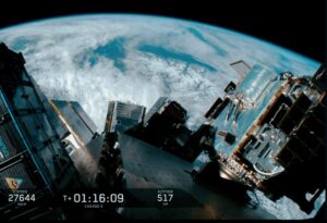
- Launched on May 3, 2026, aboard a SpaceX Falcon 9 rocket, it represents a historic milestone for India’s commercial space ecosystem.
- Objectives: The primary goal is to provide all-weather, day-and-night geospatial intelligence for national security and commercial use.
- It seeks to reduce India’s dependence on foreign satellite data for border surveillance and strategic monitoring.
- The mission also aims to validate onboard AI processing to deliver faster, analysis-ready insights directly from orbit.
- Developing Institution: GalaxEye Space, a Bengaluru-based startup founded by IIT Madras alumni, is the lead institution behind this mission.
- The project received institutional support from IN-SPACe and underwent rigorous testing at ISRO’s U R Rao Satellite Centre.
- It stands as the largest satellite project completed by a private Indian firm.
- OptoSAR Technology: The satellite features the proprietary SyncFused OptoSAR architecture.
- This technology combines Synthetic Aperture Radar (SAR) and Multi-Spectral Imaging (MSI) on a single spacecraft.
- Technical Specifications: The spacecraft weighs approximately 190 kilograms, making it India’s heaviest private satellite.
- It operates at an altitude of 500 km in a Sun-Synchronous Orbit.
- The system delivers high-resolution imagery ranging from 1.2 to 3.6 metres, optimized for detailed surface analysis.
- It has a revisit frequency of 4 days. The payload includes X-Band SAR and multi-band optical sensors like RGB and NIR.
- In-Orbit Processing: Equipped with Nvidia Jetson Orin hardware, the satellite performs advanced AI workloads in space.
- This edge computing capability allows for real-time change detection and data compression.
- It slashes the time required to deliver critical intelligence to end-users on the ground.
- Versatile Applications: Mission Drishti supports a wide range of sectors including defence, agriculture, and disaster management.
- It provides maritime monitoring and infrastructure planning data regardless of cloud cover.
- Orbital Data Centers: The mission serves as a proof-of-concept for Orbital Data Centres (ODC).
- These centers involve interconnected satellites that share processing tasks in space.
- This approach enhances the scalability and reliability of future satellite constellations while lowering overall operational costs.
- Constellation Vision: This launch is the first step toward a planned constellation of 8 to 12 satellites by 2029.
- The full network will provide sub-daily revisit times, ensuring near-real-time global updates.
- This long-term vision aims to establish a robust commercial marketplace for high-frequency satellite data.
OptoSAR Technology: Concept, Working and Innovation
OptoSAR is a pioneering satellite imaging technology that integrates two distinct sensing modalities—Synthetic Aperture Radar (SAR) and Optical/Multi-Spectral Imaging (MSI)—into a single, unified hardware platform.
- Concept: Traditionally, satellite operators have had to choose between clarity and consistency.
- Optical sensors provide intuitive, high-resolution color images but are blinded by clouds, smoke, and darkness.
- SAR sensors can “see” through these obstructions by emitting microwave pulses, but the resulting images are grayscale and difficult to interpret.
- OptoSAR eliminates this trade-off by co-locating both sensors on the same platform, allowing them to capture exact same location at the exact same time.
- Working: The operational core of OptoSAR is a proprietary technology stack called SyncFusion™:
- Hardware Co-location Both an X-Band SAR sensor and a 7-band MSI imager are housed on a single, thermally-stable optical bench. This physical alignment eliminates parallax error—the distortion caused by viewing an object from two different angles.
- Single-Pass Capture Data from both sensors is captured in a single orbital pass. This ensures that the datasets are inherently aligned (spatially, temporally, and from the same perspective).
- Edge Computing The platform uses Nvidia Jetson Orin AI hardware to process and fuse these data streams directly onboard the satellite.
- Key Innovations: OptoSAR introduces several “world-first” technical advancements to Earth observation:
- Fused Resolution It delivers a combined imagery resolution of approximately 1.8 metres, blending the detailed color of MSI with the structural precision of SAR.
- Tripled Information Density By capturing structural texture (SAR) and spectral signatures (MSI) simultaneously, the system provides three times more actionable data than a standalone sensor.
- Simplified AI Training Fused datasets provide “visual ground truth,” which significantly reduces the complexity and cost of training AI models for automatic target recognition (ATR) and change detection.
- All-Weather Reliability Unlike traditional optical constellations that can lose visibility for weeks during monsoons, OptoSAR guarantees consistent imagery regardless of lighting or weather conditions.
Significance
- Space Ecosystem Evolution: Mission Drishti shifts the Indian Space Ecosystem from ISRO-centric operations to a robust private-led model.
- By launching the heaviest private satellite at 190kg, it proves that startups can handle complex dual-use payloads.
- This creates a high-tech supply chain within India, encouraging local vendors to meet global aerospace standards.
- Policy Transformation Catalyst: The mission validates the Indian Space Policy 2023, which encourages private participation in end-to-end space activities.
- It represents the first major success under the IN-SPACe framework, providing a template for regulatory clearance and technical handholding.
- This success attracts Foreign Direct Investment (FDI) into the sector by de-risking private orbital ventures.
- Global Market Disruption: In the Global Context, Drishti challenges international giants by offering SyncFused data at a lower price point.
- Most global firms sell SAR and Optical data separately, but this hybrid approach provides three times more actionable intelligence.
- India now competes directly in the $120 billion global geospatial market with a unique technological edge.
- National Security Autonomy: The mission achieves Atmanirbhar Bharat in strategic surveillance by ending reliance on foreign imagery providers like Maxar or Airbus.
- During monsoon seasons, traditional optical satellites fail, but Drishti’s all-weather SAR ensures constant eyes on sensitive border zones.
- This provides the Indian Armed Forces with uncompromised, sovereign data for tactical planning.
- Climate and ESG Impact: The satellite provides critical data for Environmental, Social, and Governance (ESG) reporting for global corporations.
- It tracks carbon sequestration and forest degradation with higher accuracy than single-sensor systems.
- By monitoring methane leaks and industrial emissions, it becomes a vital tool for international climate accord verification.
- Economic Data Marketplace: Drishti facilitates a new commercial data marketplace for high-frequency revisit imagery.
- It serves sectors like insurance and commodities, where daily updates on crop health or port congestion drive multi-million dollar decisions.
- This mission transforms space data into a real-time economic commodity, boosting India’s digital economy footprint.
|
Also Read: ISRO to Launch PSLV-C62 Mission Carrying EOS-N1 and 18 Payloads |