




Cyclone Arnab 2026: Origin, Factors, Naming and Impacts
| General Studies Paper I: Geography, Natural Phenomena, Disaster Management |
Why in News?
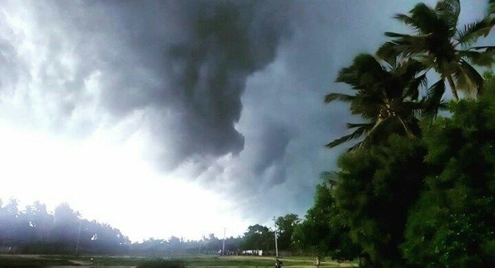
The Cyclone Arnab deep depression over the Bay of Bengal crossed the north Andhra Pradesh and south Odisha coasts during the early hours of September 24, 2026, as reported by the India Meteorological Department (IMD).
What is Cyclone Arnab 2026?
- About: Cyclone Arnab refers to a weather-system naming. The system developed over the westcentral and adjoining northwest Bay of Bengal in September 2026 and intensified into a Deep Depression. IMD did not officially name it Arnab because it did not crossed the wind speed.
- In the North Indian Ocean, RSMC New Delhi/IMD names a tropical cyclone once it reaches Cyclonic Storm intensity.
- IMD’s classification defines a Deep Depression as having 28–33 knots (50–61 km/h) maximum sustained winds, while a Cyclonic Storm begins at 34 knots (62 km/h).
- Origin & Formation: The atmospheric system originated around September 17, 2026, as an upper-air cyclonic circulation over North Thailand.
- It subsequently advanced westward across the Indochina peninsula and emerged into the North Andaman Sea by September 18.
- Feeding on warm tropical waters, it quickly evolved into a well-defined low-pressure area before drifting into the west-central Bay of Bengal.
- The low-pressure system intensified into a depression on September 21, consolidating its convective structure.
- Under favorable regional conditions, it escalated into a Deep Depression by the evening of September 22.
- It sustained this intensity while moving west-northwestward at a steady speed of 5 to 8 km/h directly toward the eastern coast of India.
- Factors: The system’s growth was driven by high Sea Surface Temperatures (SSTs) in the Bay of Bengal, hovering around 29–30°C, which provided abundant thermal energy.
- Strong low-level relative vorticity and favorable upper-level divergence allowed deep convection to persist.
- However, moderate vertical wind shear in the upper atmosphere arrested its development.
- Naming: The name ‘Arnab’ was officially designed by Bangladesh and translates to ‘ocean’ in Bengali.
- The WMO/ESCAP Panel on Tropical Cyclones maintains a pre-designated naming list for the North Indian Ocean.
- The list contains names proposed by 13 member countries. Bangladesh contributed “Arnab”, pronounced approximately “Or-nab.”
- The sequence places Arnab after Bangladesh’s earlier names Nisarga and Biparjoy in the relevant column.
- Areas Affected: The deep depression pushed inland over the early hours of September 24, 2026.
- IMD reported that it crossed the north Andhra Pradesh coast near southwest of Kalingapatnam with maximum sustained winds of 55–65 km/h and gusts up to 75 km/h.
- The system primarily targeted the North Andhra Pradesh and South Odisha coastlines.
- It affected Odisha’s Koraput, Malkangiri, Gajapati, Ganjam, Kalahandi, and Nabarangpur.
- Andhra Pradesh’s Srikakulam, Vizianagaram, Visakhapatnam, and the Yanam region.
- Outer rainbands caused significant downpours across West Bengal, Chhattisgarh, and Telangana.
- Impact:
- In the hilly terrains of Gajapati and Malkangiri, heavy saturation created high landslide risks, impacting over 140 designated vulnerable zones.
- Sea conditions remained very rough over the west-central Bay of Bengal, with large storm surges pounding the coastal ecosystem.
- Socioeconomic activity came to a halt as schools were shut down across 11 districts in Odisha and 6 districts in Andhra Pradesh.
- Infrastructural damage includes uprooted trees, collapsed temporary structures, power line disruptions, and muddy water inundated into low-lying residential sectors.
- Maritime commerce was paused as ferry services (such as the Satapada-Jahnikuda route in Chilika Lake) were suspended.
- In the hilly terrains of Gajapati and Malkangiri, heavy saturation created high landslide risks, impacting over 140 designated vulnerable zones.
- Preparedness & Management: India showcased swift disaster mobilization to target “zero casualties“.
- State authorities preemptively evacuated over 1,500 residents from highly vulnerable regions to local cyclone shelters.
- Heavy machinery, emergency rescue teams, and National Disaster Response Force (NDRF) units were deployed on standby across critical districts to clear blocked routes and manage localized emergencies.
- India uses a four-stage cyclone-warning system: Pre-Cyclone Watch, Cyclone Alert, Cyclone Warning and Post-Landfall Outlook.
- The first stage can be issued 72 hours in advance, while the Cyclone Alert is issued at least 48 hours before adverse coastal weather and Cyclone Warning at least 24 hours beforehand.
- The entire trajectory of the storm was tracked on an hourly basis using advanced Doppler Weather Radar at Visakhapatnam alongside satellite imagery.
- The Real-Time Governance Society (RTGS) and IMD disseminated timely warnings to fishermen.
- Current Status: According to the latest radar updates from Visakhapatnam, its deep convection is shrinking, indicating a gradual weakening trend as it moves further northwestward.
What is a Cyclone?
- About: A cyclone is a massive atmospheric air mass that rotates dynamically around a central zone of low atmospheric pressure.
- As the air flows inward toward this central low, the rotation of the Earth creates a spiral wind pattern.
- The word originates from the Greek term cyclos, meaning the coils of a snake.
- Direction: The rotation of cyclonic winds depends completely on the hemisphere due to the Coriolis effect.
- In the Northern Hemisphere, the winds spiral in a counterclockwise direction.
- In the Southern Hemisphere, the wind moves in a clockwise pattern.
- Formation: Cyclogenesis is the term used for the formation and intensification of a cyclone.
- It begins when warm, moist air over the ocean surface rises upward rapidly.
- This upward movement creates a localized low-pressure deficit near the water surface.
- Surrounding high-pressure air rushes inward to fill this void, gets heated, and ascends as well, creating a continuous convective cycle that forms vast storm clouds.
- Meteorological Conditions: For a tropical cyclone to develop, the sea surface temperature must be at least 27°C (80°F) or higher to supply enough thermal energy.
- There must also be a sufficient Coriolis force (usually at least 5 degrees latitude away from the equator) to initiate the spin.
- Additionally, low vertical wind shear is necessary so that the rising storm system can grow vertically without being torn apart.
- Structure: A mature cyclone typically contains an eye, eyewall and spiral rainbands:
- The center of a mature cyclone is called the eye, which spans a low-pressure area characterized by calm winds and clear skies.
- The air pressure here is at its lowest.
- Immediately surrounding the eye is the eyewall. This band contains the most violent, high-velocity winds and the heaviest, most torrential rainfall within the entire storm system.
- Radiating outward from the eyewall are long, dense spiral rainbands. These secondary clouds track inward toward the center, carrying intense squalls, localized thunderstorms, and significant amounts of moisture.
- The center of a mature cyclone is called the eye, which spans a low-pressure area characterized by calm winds and clear skies.
- Classification:
- Tropical cyclones develop over warm tropical or subtropical oceans between 5° and 30° latitudes.
- They derive their immense energy from the latent heat of condensation released as moist air rises and condenses into clouds.
- Also known as temperate or frontal cyclones, extratropical cyclones form in the mid-to-high latitudes between 30° and 65°.
- Unlike tropical systems, they are driven by horizontal temperature contrasts between colliding warm and cold air masses along weather fronts.
- Polar cyclones materialize over the icy waters of the Arctic and Antarctic regions, such as near Greenland and Siberia.
- They are typically smaller in scale and peak in intensity during the winter months.
- They cause minimal human impact due to the sparse population in these zones.
- A mesocyclone is a localized, rotating updraft of air that develops within an intense supercell thunderstorm.
- Their spinning motion can intensify and frequently serves as the precursor to tornadoes.
- Tropical cyclones develop over warm tropical or subtropical oceans between 5° and 30° latitudes.
- Naming Systems: Tropical cyclones are given different regional names based on their geographic location.
- They are called Hurricanes in the North Atlantic and Eastern Pacific, Typhoons in the Western Pacific, and simply Cyclones in the Indian Ocean and Southern Pacific.
- Intensification Scales: Storm systems are officially categorized by their maximum sustained wind speeds using metrics like the Saffir-Simpson Scale.
- Destructive Elements: Cyclones destroy coastal areas via three main phenomena: strong squall winds that rip apart infrastructure, torrential rains causing massive inland flooding, and storm surges.
- Major Hazards: Cyclones generate multiple hazards: destructive winds, torrential rainfall, coastal flooding, high waves, landslides and flash floods.
- Their impacts can cascade into power failures, transport disruption, crop losses, infrastructure damage and public-health emergencies.
- Decay: A cyclone quickly enters its decay stage when it makes landfall or moves over colder waters.
- Moving over land cuts off its primary fuel source—warm ocean moisture—while land friction rapidly disrupts the low-level wind circulation, causing the storm to break apart.
Frequently Asked Questions (FAQs):
1. What is the latest Cyclone Arnab alert in India?
IMD reports a Deep Depression, not a cyclone, after landfall; heavy-to-very-heavy rainfall remains the main threat.
2. Cyclone Arnab Odisha landfall update?
Landfall ho chuka hai; system 23–24 September ki raat Kalingapatnam ke paas coast cross kar chuka hai.
3. Which districts are under Cyclone Arnab alert?
Odisha’s warnings cover southern districts, including Ganjam, Gajapati, Koraput, Malkangiri, Nabarangpur and Kalahandi.
4. Is Cyclone Arnab affecting Andhra Pradesh?
Yes. North coastal Andhra Pradesh received strong winds and heavy rainfall after the Deep Depression crossed near Kalingapatnam.
5. Cyclone Arnab latest IMD update?
IMD says the Deep Depression moved inland after landfall, initially retaining intensity before gradually weakening.
6. What precautions are being taken for Cyclone Arnab?
Authorities activated emergency teams, evacuations, shelters and heavy machinery; fishermen and coastal communities received weather warnings.
Disclaimer: Information in this article is based on official announcements and public records. Details may evolve over time.
| Also Read: Cyclone Montha |