Agnikul-ICEYE SAR Satellite MoU
| General Studies Paper II: Space Technology, Indianization of Defence Technology |
Why in News?
Recently, Agnikul Cosmos and ICEYE signed an MoU to jointly build, launch, and operate indigenous Synthetic Aperture Radar (SAR) satellites from India.
Highlights of Agnikul–ICEYE SAR Satellite MoU
- Announcement: Indian company Agnikul Cosmos and Finland-based ICEYE signed a Memorandum of Understanding (MoU) on 30 June 2026, announced on 1 July 2026, to jointly develop an end-to-end Synthetic Aperture Radar (SAR) Earth-observation ecosystem from India.
- The partnership aims to design, manufacture, launch, and operate SAR satellites entirely from India.
- Role: Agnikul Cosmos will contribute its indigenous launch infrastructure, including its Agnibaan small satellite launch vehicle and responsive launch model, enabling faster and dedicated deployment of SAR satellites.
- Agnibaan is a highly customizable, two-stage small satellite launch vehicle.
- Designed to carry payloads ranging from 30 kg to 300 kg to Low Earth Orbit (LEO), it is propelled by the world’s first single-piece 3D-printed semi-cryogenic rocket engine.
- It can be easily configured to carry different payload weights without changing the fundamental launch cost across the 30 kg to 300 kg spectrum.
- It uses the indigenously designed “Agnilet” engine, which is additively manufactured as a single piece, dramatically reducing the number of parts and manufacturing time.
- The vehicle is designed to be launched from transportable, mobile launch platforms, offering flexible, plug-and-play launch operations.
- It successfully executed the maiden test flight of the vehicle, known as Agnibaan SOrTeD (Suborbital Technological Demonstrator), from India’s first privately-developed launchpad (“Dhanush”) at Sriharikota.
- ICEYE will provide its globally proven SAR satellite technology, manufacturing expertise, and operational experience.
- The company currently operates the world’s largest SAR constellation with over 70 satellites in orbit.
- Integrated Ecosystem: The collaboration seeks to establish a complete Indian SAR value chain, integrating satellite production, launch services, mission operations, and data delivery.
- Beyond domestic missions, both companies intend to serve international sovereign and commercial customers, positioning India as an Asia-Pacific manufacturing and launch hub for advanced SAR satellites.
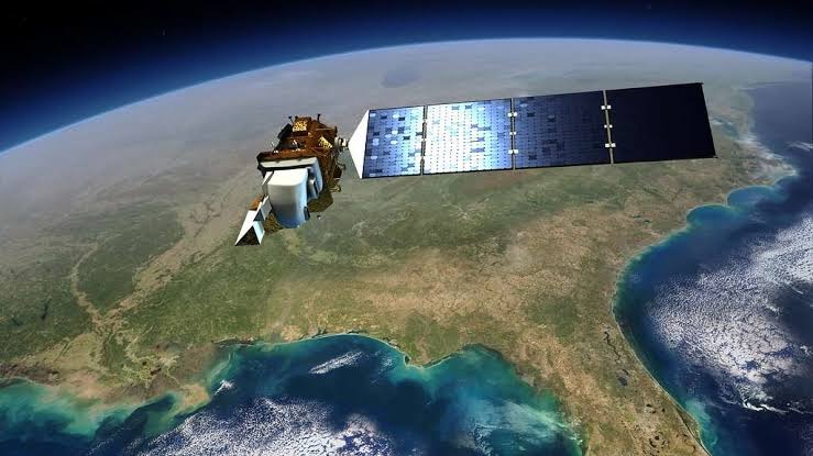
What is a Synthetic Aperture Radar (SAR) Satellite?
- About: A Synthetic Aperture Radar (SAR) satellite is an active Earth-observation satellite that transmits microwave radar pulses toward Earth and records the reflected signals (backscatter) to generate high-resolution images.
- Unlike optical satellites, it produces imagery independently of sunlight.
- Working Principle: SAR continuously emits radar pulses while moving in orbit.
- Advanced processing combines echoes from multiple positions to create a “synthetic aperture”, effectively simulating a much larger antenna.
- This significantly improves image resolution without requiring a physically massive antenna.
- The term “synthetic aperture” refers to the virtual enlargement of the radar antenna through the satellite’s motion.
- This computational technique enables fine azimuth resolution that would otherwise require an impractically large spaceborne antenna.
- Features: Because SAR uses microwave frequencies, it can image through clouds, rain, fog, smoke, and complete darkness. This makes it one of the most reliable remote-sensing technologies.
- SAR satellites commonly operate in X-band (~3 cm) for fine surface detail, C-band (~5.6 cm) for balanced monitoring, and L-band (~23–24 cm) for greater vegetation and soil penetration.
- SAR measures the strength, time delay, and phase of returned radar signals. These reveal surface roughness, moisture, structure, topography, deformation, and land-cover characteristics.
- SAR supports disaster response, flood mapping, agriculture, forest monitoring, glacier observation, urban planning, oil-spill detection, infrastructure assessment, and ground deformation studies with frequent repeat observations.
- Governments use SAR satellites for border surveillance, maritime domain awareness, ship detection, military reconnaissance, and critical infrastructure monitoring.
- Limitations: SAR imagery requires complex signal processing and expert interpretation because radar images differ from photographs.
- Geometric distortions such as layover, foreshortening, and shadowing may occur over rugged terrain.
Significance of This Partnership
- Strengthening India’s Sovereign Space Capability: The partnership aims to establish a sovereign SAR Earth-observation ecosystem in India.
- This reduces dependence on foreign technology, launch schedules, and overseas infrastructure for strategic missions.
- India gains greater control over mission planning, deployment schedules, and operational autonomy.
- Technology Transfer and Industrial Growth: The collaboration enables India to leverage ICEYE’s globally proven SAR expertise, including technology already deployed for seven European governments.
- Domestic manufacturing will strengthen India’s high-technology industrial base and expand advanced aerospace capabilities.
- Acceleration of India’s Private Space Sector: The agreement showcases the growing role of Indian private space startups after space-sector reforms.
- It demonstrates how private enterprises can build strategic national capabilities alongside public institutions, expanding India’s commercial space ecosystem.
- Advancing India’s Long-Term Space Vision: The partnership aligns with India’s broader objectives of Atmanirbhar Bharat, Make in India, and expansion of the commercial space economy.
- It creates the foundation for an indigenous, globally competitive space-based intelligence infrastructure supporting both national priorities and international markets.
India’s Earth Observation (EO) Ecosystem
- Early Experimental Phase (1979-1981): India’s first steps into remote sensing featured the experimental Bhaskara-1 and Bhaskara-2 satellites.
- These early payloads utilized rudimentary optical and microwave sensors to test the viability of space-borne data for resource mapping.
- IRS Program Dawn (1988): The contemporary Indian Remote Sensing (IRS) program formally began with the successful launch of IRS-1A.
- It provided advanced spatial imagery to boost national capacities in agriculture and forestry.
- Dedicated Cartography (2005): With the launch of Cartosat-1, ISRO introduced high-resolution panchromatic cameras.
- Cartosat-3 (2019) delivered among ISRO’s highest-resolution optical imagery.
- This series forms the backbone of India’s urban planning, digital elevation modeling (DEM), and terrain analysis.
- Microwave Imaging (2009-2012): The launch of RISAT-2 and later RISAT-1 (2012) granted India all-weather, day-and-night Synthetic Aperture Radar (SAR) capabilities.
- This was critical for flood monitoring and disaster management through thick cloud covers.
- Specialized Oceanography (1999-2013): Starting with Oceansat-1 and extending through Oceansat-2 and SARAL, these satellites track ocean winds, phytoplankton, and sea-surface heights to assist marine meteorology and coastal mapping.
- Resource Exploration (2003-2016): The Resourcesat series (e.g., Resourcesat-2 and 2A) provides repetitive, multi-spectral data.
- These spacecraft are extensively used for crop acreage estimation, soil classification, and mineral prospecting.
- Geo-Imaging Advancements (2021): The deployment of the EOS series (starting with EOS-01) replaced heritage missions, ensuring mission continuity.
- The EOS-03 (GISAT) series also pioneered the use of agile Earth observation from a Geostationary orbit.
- Recent missions including EOS-04, EOS-06, EOS-07, and EOS-09 expanded India’s capabilities in ocean monitoring and radar imaging.
- NISAR Mission (2025): The NASA-ISRO SAR (NISAR) mission became a global milestone in cryosphere and ecosystem monitoring.
- This L-band and S-band radar satellite provides unprecedented tracking of tectonic deformation and surface changes.
- SPADEX Technology (2025): ISRO successfully executed the Space Docking Experiment (SPADEX), providing autonomous docking capabilities.
- This represents a foundational milestone for maintaining future Earth observation satellite constellations and space stations.
- Multi-Sensor Integration (2026): Bengaluru-based space startups like GalaxEye Space deployed “Mission Drishti”, a first-of-its-kind satellite combining optical and synthetic aperture radar (SAR) in a single platform.
- Following India’s space-sector reforms, private firms such as Agnikul Cosmos, Pixxel, and others entered the Earth-observation ecosystem.
FAQs:
1. What is the Agnikul–ICEYE SAR Satellite MoU?
It is an agreement to jointly build, launch, and operate SAR Earth-observation satellites from India for sovereign and commercial missions.
2. What is a Synthetic Aperture Radar (SAR) satellite?
A SAR satellite uses microwave radar to capture high-resolution Earth images during day, night, and cloudy weather.
3. Why is the Agnikul and ICEYE partnership significant?
It strengthens India’s sovereign space capability, reducing dependence on foreign manufacturing and launch providers.
4. How are SAR satellites different from optical satellites?
SAR satellites use radar, unlike optical cameras, enabling imaging through clouds and darkness.
5. What applications do SAR satellites have?
They support disaster response, border surveillance, agriculture, maritime monitoring, environmental observation, and security.
6. How will this collaboration benefit India’s space sector?
It promotes indigenous manufacturing, responsive launches, technology transfer, and commercial growth in India’s private space industry.
7. Who are Agnikul and ICEYE?
Agnikul Cosmos is an Indian launch startup; ICEYE is a Finnish SAR satellite company operating over 70 satellites.
8. Will the partnership involve satellite launches?
Yes, satellites are planned to launch using Agnikul’s indigenous responsive launch vehicles, including Agnibaan.
9. What industries benefit from SAR satellite technology?
Defence, agriculture, insurance, infrastructure, maritime, disaster management, environmental monitoring, and geospatial intelligence benefit significantly.
10. How does SAR imaging work in all weather conditions?
It transmits microwave radar signals that penetrate clouds and operate independently of sunlight.
Disclaimer: Information in this article is based on official announcements and public records. Regulations and implementation details may evolve over time.