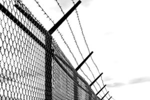
India-Bangladesh Border Fencing
|
General Studies Paper II: India’s Neighborhood, Security Challenges & their Management in Border Areas |
Why in News?
Recently, West Bengal began transferring land to the BSF for barbed-wire fencing along vulnerable India-Bangladesh border stretches.
- WB Government handovers land of 27 kilometers out of which 18 kms for fencing and 9 kms for BSF outposts and infrastructure.
India-Bangladesh Border
- Longest Boundary: India-Bangladesh border is India’s longest international land boundary, stretching 4,096.7 km across the five specified states.
-
-
- It is the fifth-longest land border globally.
- It passes through West Bengal (2216.7 km), Assam (263 km), Meghalaya (443 km), Tripura (856 km) and Mizoram (318 km).
- Historical Origin: The boundary originates from the 1947 Radcliffe Line, separating India from East Pakistan.
- Following the 1971 Bangladesh Liberation War, this line transitioned into the official international boundary between India and Bangladesh.
- Geographical Features: The topography features extremely porous terrain, including dense riverine networks, marshlands, and valleys. Both sides of the border suffer from high population density, often exceeding.
- Security Operation: The Border Security Force (BSF) manages security coordination with Bangladesh’s Border Guard Bangladesh (BGB).
- They contend with constant challenges like organized cross-border smuggling (fake currency, cattle, narcotics) and human trafficking networks exploiting the porous sections of the boundary.
- Trade Infrastructure: Over 40 Land Customs Stations (LCS) and Integrated Check Posts (ICP) facilitate bilateral commerce, with Petrapole-Benapole being the largest land port.
- To promote local economic cooperation, designated Border Haats operate along remote stretches, allowing local residents to trade specific indigenous products without formal customs duties.
-
- Significance: The boundary is strategically critical for national security, trade connectivity, counter-insurgency operations and India’s Act East Policy.
- It links mainland India with the northeastern states through the vulnerable Siliguri Corridor.
Status of Fencing Along India-Bangladesh Border
- Sanctioned Length: The Ministry of Home Affairs (MHA) has officially authorized a total sanctioned distance of 3,436.59 kilometres for physical fence construction out of the total 4,096.70 kilometres international boundary.
- Completed Distance: India has successfully erected structural barriers along 3,239.92 kilometres of the shared frontier.
- This progress leaves approximately 79.08 percent of the eastern line physically secured.
- State Allocation; In West Bengal, which shares the largest segment of 2,216.70 kilometres, fences protect 1,647.70 kilometres. The rest is partitioned across Tripura, Meghalaya, Mizoram, and Assam based on tactical requirements.
- Unfenced Sectors: Approximately 856.78 kilometres remain open without physical fencing.
- This includes 174.51 kilometres explicitly classified as permanently non-feasible gaps owing to steep ridges, dense forests, and waterbodies.
- Smart Surveillance: To defend non-feasible riverine patches like the Brahmaputra basin, India deploys the Comprehensive Integrated Border Management System (CIBMS).
- This technological grid incorporates laser walls, thermal imagers, and underground sensors.
- Operational Infrastructure: Fencing works operate alongside auxiliary security installations. The government has built over 3,750 kilometres of border roads and set up thousands of kilometres of floodlighting to allow smooth night patrolling.
- Defense Upgrades: The Border Security Force (BSF) is actively replacing old single-row defenses with modern composite multiple-row concertina wire.
- This shift maximizes resistance against cross-border smuggling, illegal infiltration, and human trafficking networks.
Challenges and Disputes Related to India-Bangladesh Border Fencing
- Zero Line Restriction: Under the 1975 Joint India-Bangladesh Guidelines, constructing military defenses within 150 yards of the Zero Line is prohibited.
- India builds single-row fencing here for anti-smuggling security, but the Border Guards Bangladesh (BGB) repeatedly block work, labeling it a defensive military violation.
- Acquisition Delays: Erecting barriers requires vast stretches of private territory, creating complex land acquisition processes.
- State-level administrative holdups, slow regulatory clearances, and localized valuation disputes consistently stall the deployment of vital security structures.
- Riverine Gaps: Natural topography leaves over 864 kilometres unfenced, including a permanent 174-kilometre non-feasible gap.
- Major river channels like the Brahmaputra dynamically shift course, eroding permanent physical infrastructure and creating unsecured transit corridors.
- Domestic Resistance: The boundary cuts through densely populated rural sectors where houses sit adjacent to the international border.
- Local farmers stage frequent public protests because physical fences separate families from ancestral agricultural lands and sever daily village movement.
- Surveillance Objections: To secure unfeasible patches, India installs a high-tech CIBMS System.
- Bangladesh formally opposes these smart fencing networks, asserting that advanced thermal imagers and laser walls infringe on national sovereignty by monitoring internal foreign territory.
- Seasonal Disruptions: Harsh environmental factors trigger severe structural degradation along the eastern frontier.
- Intense monsoon floods, sudden landslides, and marshy terrain submerge fencing poles, causing widespread structural failure and limiting active construction to a very compressed yearly window.
- Enclave Triggers: Post-2015 territorial adjustments left lingering geopolitical hotspots.
- In highly sensitive zones like the Dahagram-Angarpota enclave, building barriers triggers immediate bilateral standoffs.
- Frequent firing incidents and civilian deaths involving the BSF and Border Guard Bangladesh (BGB) generate diplomatic tensions.
- Human rights organizations regularly criticize excessive force along vulnerable border sectors.
- Trans-Boundry Crime: Around 60% of trans-border crimes along the India-Bangladesh boundary occur in unfenced areas, particularly where villages sit directly on the international line.
- While India argues that fencing is crucial to curb illicit activities like smuggling, Bangladesh opposes it.
|
India-Bangladesh Border Guidelines: India-Bangladesh border guidelines are governed by the 1975 Joint India-Bangladesh Guidelines and the Coordinated Border Management Plan (CBMP), enforced by BSF and BGB.
|
Government Policies Related to India-Bangladesh Border Fencing
- Physical Border Fencing Initiative: The government is actively closing the remaining physical gaps, particularly in West Bengal, where state authorities have actively expedited land transfers to the BSF.
- Smart Border Management Projects: The Home Ministry has prioritized rolling out comprehensive “Smart Border” technologies to secure vulnerable terrain.
- Comprehensive Integrated Border Management System (CIBMS) seamlessly integrates manpower, sensors, and intelligence for real-time situational awareness.
- In complex riverine stretches—such as the Brahmaputra River—the BSF operates BOLD-QIT (Border Electronically Dominated QRT Interception Technique). This creates a data network of microwave communication.
- Border Infrastructure and Management (BIM) Scheme: With an approved budget of Rs. 13,020 crore, the BIM Scheme funds vital logistical developments.
- This includes constructing border roads, floodlights, helipads, and Border Out Posts (BOPs) to boost continuous troop mobility.
- Riverine and Floating Border Out Posts: Since many vulnerable border areas have shifting river channels, the BSF deploys floating BOPs and fast interceptor boats.
- These waterborne platforms ensure 24-hour patrolling where land-based physical fencing is not feasible.
- In an internal communication, the BSF directed its field units to examine using crocodiles and venomous snakes as natural psychological barriers.
- Intelligence and Anti-Human Trafficking Units: To tackle cross-border syndicates, 15 specialized Anti-Human Trafficking Units have been deployed.
- Furthermore, local intelligence networks are reinforced to track touts and illegal border crossers.
- Coordinated Border Management Plan (CBMP): India and Bangladesh coordinate border management by strictly implementing the CBMP, allowing joint operations and regular meetings between border nodal officers to reduce cross-border crimes.
- BADP Development: The MHA manages the Border Area Development Programme (BADP) alongside the vibrant villages model to strengthen frontier society.
- This policy funds critical social infrastructure, local roads, and schools to discourage depopulation and boost indigenous security cooperation.
|
Also Read: India Fenced Over 93% Fencing with Pakistan and Nearly 80% with Bangladesh |