


UN Votes to Adopt New Africa True Size Map, Replacing 16th-Century Mercator Projection
| General Studies Paper II: Groupings & Agreements Involving India and/or Affecting India’s Interests |
Why in News?
Recently, the United Nations General Assembly (UNGA) voted to adopt a new Africa true size map under “Correct the Map” resolution, dismantling the 16th century-old Mercator Projection.
UN “Correct the Map” Resolution Highlights
- Resolution: The “Correct the Map” initiative seeks to improve how the relative sizes of continents are represented on world maps.
- It particularly highlights the visual under-representation of Africa in commonly used Mercator Maps (Mercator Projection).
- The initiative was spearheaded by Togo and supported by African states and the African Union (AU).
- Togo presented the issue as both a cartographic and broader representational concern.
- UN Adoption: The UN General Assembly adopted the resolution on 4 September 2026 at United Nations Headquarters in New York. The decision came during the Assembly’s current session.
- The resolution encourages wider use of maps that show continental areas more accurately.
- Its main focus is correcting distortions that make high-latitude territories appear disproportionately large.
- The resolution promotes the Equal Earth projection, developed as an equal-area world-map projection.
- Voting Outcome: The resolution received 164 votes in favour, 1 against, and 6 abstentions. The United States was the only country voting against it.
- India voted in favour of the resolution. This places India among the broad majority supporting more accurate global cartographic representation.
- Under Article 18 of the UN Charter, every General Assembly member has one vote.
- Ordinary questions generally require a majority of members present and voting, while specified important questions require two-thirds.
- India voted in favour of the resolution. This places India among the broad majority supporting more accurate global cartographic representation.
- Nature: This resolution is not legally binding on UN member states.
- General Assembly resolutions normally function as recommendations, unlike binding Security Council decisions under the Charter framework.
- The resolution does not prohibit Mercator maps. It also does not prevent their continued use for maritime and aerial navigation.
What is Mercator Projection?
- About: The Mercator projection is a cylindrical map projection introduced by Flemish geographer Gerardus Mercator in 1569 that prioritizes accurate compass direction over true land size.
- He published the revolutionary map to solve practical challenges in marine navigation.
- It became one of the most influential projections in the history of world mapping.
- Characteristics:
- It is conceived by projecting the spherical Earth onto a cylinder wrapped around the equator, with latitude spacing increasing toward the poles.
- Its major advantage was making rhumb lines—routes of constant compass bearing—appear as straight lines.
- Mercator is conformal, meaning it preserves local angles and directions. This property is highly useful for mapping applications.
- Its parallels (lines of latitude) and meridians (lines of longitude) intersect at 90-degree angles.
- Its longitude lines are equally spaced, but the distance between latitude lines increases dramatically toward the poles.
- A straight line drawn on a Mercator map represents a line of constant bearing (loxodrome or rhumb line).
- Limitations:
- Because much of Africa lies near the Equator, it experiences relatively less scale enlargement than northern landmasses.
- Greenland can appear comparable to Africa on Mercator maps, although Africa’s actual area is roughly 14 times larger.
- The projection also visually enlarges parts of Europe and North America because they lie at higher latitudes than most of Africa.
- Due to the biases of the Mercator map, the Gall-Peters Projection is often discussed as an alternative.
- It is a rectangular map that shows the correct relative sizes of Earth’s landmasses by trading away accurate shapes.
What is Equal Earth Projection which UN Resolution Promotes?
- About: The Equal Earth projection was designed in 2018 by cartographers Bojan Šavrič, Tom Patterson and Bernhard Jenny.
- Equal Earth was inspired partly by the Robinson projection, which prioritises overall visual balance.
- Classification: It is an equal-area pseudocylindrical projection designed specifically for representing the world’s continents and countries.
- Principle: Its central principle is area preservation. Countries and continents maintain their correct relative areas, making comparisons between Africa, Europe, Greenland and other regions more meaningful.
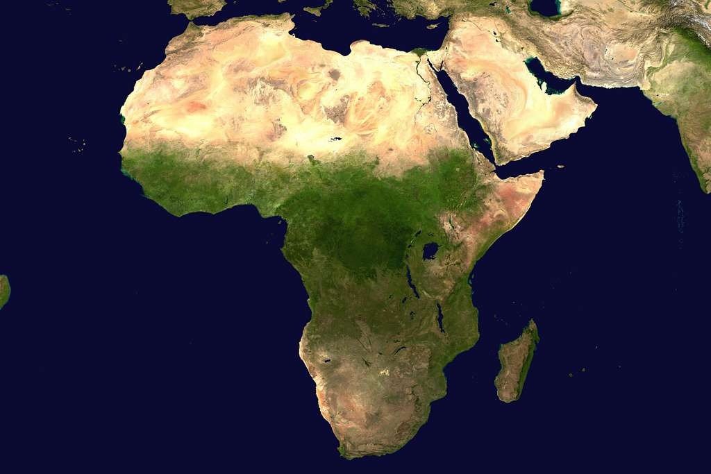
- Africa therefore appears much closer to its true relative size than on Mercator maps. Its enormous geographical extent becomes visually clearer.
- Under Equal Earth, Greenland no longer appears comparable to Africa in area.
- Unlike some equal-area projections, Equal Earth aims to retain recognisable continental shapes. This makes it visually useful for education and general world maps.
- Features: The projection uses straight parallels, helping users understand north-south positions and compare latitude more easily.
- Its curved sides visually suggest Earth’s spherical form. This creates a more natural appearance than a simple rectangular world map.
- The projection is optimized at roughly 44°14′ North and South, meaning distortion is minimal along these mid-latitude belts.
- The projection can be implemented in GIS and mapping software.
Africa’s Actual Geographical Scale:
- Africa is the world’s second-largest continent by area, after Asia. Its enormous size is often underestimated when viewed through distorted world maps.
- Africa covers approximately 30.37 million square kilometres, including its islands. This makes it larger than most popular mental images suggest.
- Africa is roughly three times the area of the United States. This comparison helps explain how strongly conventional world maps can influence perceptions of continental scale.
- China covers 9.60 million square kilometers and fits within African borders alongside other large nations.
- Africa extends from the Mediterranean region in the north to the southern tip of South Africa. Its geographical span covers a huge range of climatic and ecological zones.
- The continent stretches from the Atlantic Ocean to the Indian Ocean. This broad longitudinal extent contributes to Africa’s immense geographical diversity.
- Africa contains deserts, tropical forests, savannas, mountains, plateaus and major river systems. Its scale therefore matters for climate and biodiversity studies.
- Africa’s geographical scale also has major implications for population distribution, resources, transport, agriculture and urbanisation. Physical size alone, however, should not be confused with population or economic weight.
Significance of the UN’s New World Map
- Correcting Geographical Distortion: It encourages maps that represent relative land areas more accurately. The new approach makes this difference visually clearer.
- Decolonising Knowledge: Supporters argue that geographical education should not continue relying mainly on representations inherited from earlier historical periods when better alternatives are available.
- Educational Impact: More accurate area representation can improve students’ understanding of continental size, spatial relationships and global geography. Togo has indicated plans to update its school geography materials.
- Cognitive Justice: The campaign connects cartographic accuracy with “cognitive justice”—the idea that communities should not be disadvantaged by persistent misrepresentations of their geographical reality.
- Digital Mapping Implications: This could influence digital mapping platforms, GIS systems, educational software and location-based services. However, specialised applications will continue using different projections.
- Diplomatic Importance: The resolution represents an important example of African diplomatic agenda-setting at the UN.
- Equal-area mapping gives greater visual prominence to Africa, Latin America, South Asia and other tropical regions whose areas are relatively understated on Mercator maps. The issue has significance for the broader Global South.
- For India, the issue is relevant to Geography, Global South diplomacy and India-Africa relations.
Frequently Asked Questions (FAQs):
1. What is the New World Map proposed to reflect Africa’s true size?
The Equal Earth projection is proposed because it preserves relative land areas, showing Africa’s geographical size more accurately.
2. Why does Africa appear smaller on traditional world maps?
Mercator projection enlarges high-latitude regions while relatively reducing the visual size of equatorial Africa.
3. What is the Mercator Projection and how does it distort Africa’s size?
Created in 1569, Mercator is a conformal projection that preserves angles but greatly exaggerates areas farther from the Equator.
4. Why is the True Size of Africa important for understanding global geography?
Accurate area representation improves understanding of continental scale, spatial relationships and Africa’s geographical significance in global education.
5. Has the United Nations officially adopted a new world map to show Africa accurately?
Yes, but through a non-binding resolution endorsing Equal Earth; it does not legally ban Mercator or mandate universal replacement.
Disclaimer: Information in this article is based on official announcements and public records. Regulations and implementation details may evolve over time.