


Google India-First Agricultural AI Models Launched, Aims to Boost Farm Productivity
| General Studies Paper I: Agriculture, E-Technology in the Aid of Farmers |
Why in News?
Google DeepMind’s AnthroKrishi team launched India-first artificial intelligence models ALU and AMED, designed specifically for agriculture to support local farmers and improve crop yields.
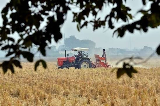
Google’s India-First Agricultural AI Models: ALU and AMED Explained
- Models: Google DeepMind’s AnthroKrishi team developed two agriculture-focused AI models: Agricultural Landscape Understanding (ALU) and Agricultural Monitoring & Event Detection (AMED).
- They are designed for India’s agricultural landscape and India-first artificial intelligence models.
- They use remote sensing, satellite imagery and machine learning to generate field-level agricultural intelligence.
- ALU: Agricultural Landscape Understanding (ALU) focuses primarily on understanding the physical agricultural landscape.
- It can identify field boundaries, water bodies and vegetation features from high-resolution imagery.
- It features 15 years of historical depth and updates every 6 months.
- This creates a digital representation of agricultural land that can support land management, acreage estimation, drought planning and other applications.
- AMED: Agricultural Monitoring & Event Detection (AMED) builds upon ALU and adds information about agricultural activity within identified fields.
- It provides field-level crop information, crop seasons, crop history and agricultural events.
- It features 6 years of historical data and refreshes every 15 days, allowing more frequent monitoring than static agricultural maps.
- It covers 12 crops, including bajra, chilli, corn, cotton, gram, groundnut, mustard, rice, sorghum, soybean, sugarcane and wheat. Google states that the crop list is expected to expand over time.
- It uses public satellite sources such as Sentinel-1, Sentinel-2 and Landsat 8 and 9. AMED can use relatively coarser satellite pixels but still produce predictions at the individual-field level using ALU-defined boundaries.
- Expansion: Google integrated ALU and AMED agricultural data into Google Earth and expanded these mapping tools to several African nations.
- Google Earth added these data models as visual layers and expanded coverage to Kenya, Uganda, Ghana, Rwanda, Nigeria, and Zambia after early tests in the Asia-Pacific region.
- This can convert global scattered agricultural information into standardised, frequently updated geospatial intelligence.
Significance of Satellite-Based Agricultural AI Models
- AMED can provide information on what crop is being cultivated, its season and historical agricultural activity. This can support better monitoring of sowing, crop development and agricultural events.
- AI-generated field intelligence can support targeted use of irrigation, fertilisers and crop-protection measures.
- Climate change creates greater uncertainty through droughts, floods, heat stress and changing rainfall patterns.
- Combining satellite observations with weather and climate data can help identify vulnerable areas and support climate-resilient farming decisions.
- Satellite-based agricultural intelligence can be combined with weather and water-resource information to improve irrigation planning.
- In Karnataka, ALU and AMED outputs are being combined with local weather and remote-sensing data through the Karnataka Water Resources Information System for dynamic water management across 2.6 million hectares of irrigated area.
- Agricultural lending often faces information gaps involving land, crop activity, farm income and risk.
- Digital agricultural intelligence can help financial institutions reduce uncertainty.
- Digital monitoring can also support climate-finance and carbon-credit programmes.
- CarbonFarm uses the ALU API and Gemini to support low-carbon rice farming, aiming to reach 2 million hectares by 2030.
- Combining field information with weather, remote sensing and hydrological data can help authorities plan irrigation and improve water productivity.
- Karnataka’s system demonstrates how agricultural AI can contribute to river-basin planning and local food-security decisions.
- The same datasets can support procurement, insurance, credit, advisory services, input planning and policy analysis. Thus, AI can connect previously fragmented stages of the agricultural value chain.
- TerraStack is an IIT Bombay-incubated startup that uses these APIs to map more than 140 million hectares of farmland.
- The FAO geoAI4stats initiative plans to integrate ALU and AMED datasets into CROPGRIDS, helping automate crop detection, generate agricultural maps and update agricultural statistics more efficiently.
- Google states that the FAO initiative is supported by $2.5 million from Google.org through the AI Collaborative: Food Security.
| Limitation: ALU based satellite imagery does not itself establish legal ownership. Therefore, AI-generated boundaries should not automatically be treated as legally verified land titles. |
Government Initiatives for AI-Driven Sustainable Agriculture
- India is developing a dedicated Digital Public Infrastructure (DPI) for agriculture under the Digital Agriculture Mission.
- Its major components include AgriStack, Krishi Decision Support System (KDSS) and a comprehensive Soil Fertility and Profile Map.
- AgriStack is a farmer-centric DPI designed to improve agricultural service delivery.
- Its foundational registries include the Farmers’ Registry, Geo-Referenced Village Maps and Crop Sown Registry. These are created and maintained by States and Union Territories.
- Its major components include AgriStack, Krishi Decision Support System (KDSS) and a comprehensive Soil Fertility and Profile Map.
- The Digital Agriculture Mission, approved in September 2024, has an outlay of ₹2,817 crore. It aims to build a farmer-centric digital ecosystem using AgriStack, KDSS, soil mapping, digital crop surveys and modern technologies.
- The KDSS combines geospatial information with weather, satellite, drought, flood, groundwater and water-availability data.
- It is also designed to support crop-yield and insurance modelling, creating an important foundation for data-driven agricultural decisions.
- Google reports that ALU and AMED are also being used in Krishi DSS.
- It is an agricultural decision-support platform being developed for the Department of Agriculture and Farmers Welfare.
- The National Pest Surveillance System (NPSS) uses AI and machine learning to support pest detection and timely intervention.
- According to the Ministry of Agriculture and Farmers Welfare, the system supports 66 crops and more than 432 pest types and is used by more than 10,000 extension workers.
- Kisan e-Mitra is an AI-powered, voice-enabled chatbot designed to answer farmer queries concerning schemes and agricultural services.
- By December 2025, it had answered more than 93 lakh queries and was handling over 8,000 farmer queries daily in 11 regional languages.
- An AI-based pilot for local monsoon-onset forecasting for Kharif 2025 reached 3.88 crore farmers across 13 States through SMS.
- Government-backed tools such as YES-TECH, CROPIC and the PMFBY WhatsApp Chatbot are using AI-enabled technologies to improve aspects of crop-insurance assessment, transparency and service delivery.
- A major recent development is Bharat-VISTAAR, a multilingual, AI-powered, voice-first agricultural DPI.
- The Government launched its Phase-1 in March 2026. It integrates government digital ecosystems and ICAR agricultural knowledge to provide location-specific advisories on areas such as crop management, weather, markets, pests, diseases and soil health.
- The Government of Telangana has integrated ALU and AMED datasets into its Agriculture Data Exchange (ADeX).
- The ecosystem is intended to support agricultural innovation and services for more than five million farmers.
- Applications include field-survey reconciliation, crop-stress diagnosis and hyperlocal advisories.
Frequently Asked Questions (FAQs):
1. What are Google’s India-first agricultural AI models?
Google’s India-first agricultural AI models are ALU and AMED, built to provide field-level agricultural intelligence using remote sensing and machine learning.
2. Which agricultural AI models has Google DeepMind developed?
Google DeepMind’s AnthroKrishi team developed Agricultural Landscape Understanding (ALU) and Agricultural Monitoring & Event Detection (AMED) models.
3. What is the Agricultural Landscape Understanding model?
ALU identifies agricultural fields, water bodies and vegetation boundaries, creating geospatial intelligence for agricultural planning and management.
4. What is the Agricultural Monitoring and Event Detection model?
AMED provides field-level crop information, seasons, historical activity and agricultural events, with data refreshed approximately every 15 days.
5. How will Google AI benefit Indian farmers?
Google AI can support crop monitoring, climate-risk assessment, credit access, irrigation planning, crop advisories and more targeted agricultural decisions.
6. Are Google’s agricultural AI models available outside India?
Yes. Their outputs have expanded to Asia-Pacific, while applications now extend to six African countries, including Kenya and Nigeria.
Disclaimer: Information in this article is based on official announcements and public records. Regulations and implementation details may evolve over time.
| Also Read: Bharat-VISTAAR AI Platform for Farmers |